


")
")
")
")

Master's Dissertation
DOI
https://doi.org/10.11606/D.3.2007.tde-25062007-154820
Document
Author
Full name
Adilson Haroldo Piveta
E-mail
Institute/School/College
Knowledge Area
Date of Defense
Published
São Paulo, 2007
Supervisor
Committee
Cintra, Jorge Pimentel (President)
Demétrio, Valdemar Antonio
Paciléo Netto, Nicola
Demétrio, Valdemar Antonio
Paciléo Netto, Nicola
Title in Portuguese
Desenvolvimento de metodologia de cartografia digital para a recuperação de divisas de imóveis rurais através de escrituras e memoriais antigos.
Keywords in Portuguese
Aviventação de divisas
Cartografia digital
Descrições antigas de imóveis rurais
Patrimônio público imobiliário
Cartografia digital
Descrições antigas de imóveis rurais
Patrimônio público imobiliário
Abstract in Portuguese
Esta dissertação de mestrado propõe técnicas de Cartografia Digital para um melhor embasamento técnico do Estado na defesa do patrimônio imobiliário estadual em ações judiciais que versem sobre questões relacionadas ao direito de uso e ocupação de terras públicas, em grande parte situadas em áreas de preservação ambiental e que resultam, muitas vezes, em indenizações milionárias contra o Estado. Segundo COSTA NETO (2006), a confusão que predomina na documentação da propriedade imobiliária em unidades de proteção integral favorece a ocorrência de ações ilegais e dificulta a resolução de conflitos, constituindo um dos principais obstáculos às ações governamentais para implantação e proteção dessas unidades. Favorece, ainda, a existência da denominada "indústria das desapropriações", por meio de uma corrida em busca de grandes somas de indenizações pelo poder público. Desta forma, torna-se fundamental a adoção de procedimentos técnicos que incorporem metodologias modernas de Cartografia Digital a fim de que possam ser compatibilizadas plantas, escrituras e memoriais descritivos antigos à bases cartográficas georreferenciadas e unificadas, a fim de agilizar trabalhos de defesa dos interesses do Estado, poupando o erário público de indenizações improcedentes. Para tanto, tomou-se como objeto de estudos a Reserva Florestal do Curucutú, imóvel do Governo do Estado de São Paulo, com características técnicas bastante diversificadas, e que bem serviu de paradigma para o estabelecimento e aplicação dos procedimentos nos demais imóveis.
Title in English
Development of methodology of digital cartography for the recovery of verge of country property through old technical description.
Keywords in English
Digital cartography
Geodetic surveys of country property
Old descriptions os country property
Revivification of verge
State common wealth
Geodetic surveys of country property
Old descriptions os country property
Revivification of verge
State common wealth
Abstract in English
This master thesis proposes techniques of Digital Cartography for the enhancement of the technical bases of the State in the defense of its real state patrimony in judicial actions regarding the issues related to the right of use and occupation of public lands, in great part located in areas of environmental preservation resulting, many times, in millionaire indemnifications against the State. According to COSTA NETO (2006), the predominant confusion on the real state property documentation in units of whole protection favors the occurrence of illegal actions and turns the conflicts resolution difficult, constituting one of the main hindrances to the governmental actions for the implementation and protection of those units. It favors yet the existence of the so called "Power to Seize Industry", through a rush in search of great sum of indemnifications by the Public Power. Therefore, it is of fundamental importance the adoption of technical procedures which incorporate modern methodologies of Digital Cartography so the plans can be compatible, deed and old descriptive memorials to cartographic bases geo-referred and unified, in order to streamline the work in defense of the State interests, saving the treasury from unsuitable indemnifications. For in such a way, the Forest Reserve of the Curucutú was overcome as object of studies, property of the Government of the State of São Paulo, with characteristics techniques sufficiently diversified, and that it served of paradigm for the establishment and application of the procedures in the excessively immovable ones well.
WARNING - Viewing this document is conditioned on your acceptance of the following terms of use:
This document is only for private use for research and teaching activities. Reproduction for commercial use is forbidden. This rights cover the whole data about this document as well as its contents. Any uses or copies of this document in whole or in part must include the author's name.
This document is only for private use for research and teaching activities. Reproduction for commercial use is forbidden. This rights cover the whole data about this document as well as its contents. Any uses or copies of this document in whole or in part must include the author's name.
ANEXOA_MEMORIALDECRETO46544.pdf (1.88 Mbytes)
ANEXOB_MEMORIALCERTIDAODESAPROPRIACAO.pdf (6.84 Mbytes)
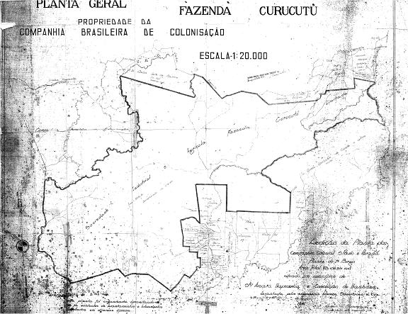
ANEXOC_PLANTACURUCUTUANTIGA.jpg (71.44 Kbytes)
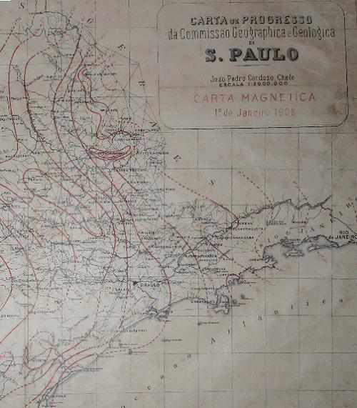
ANEXOD_CARTAMAGNETICA1908.jpg (59.06 Kbytes)
ANEXOE_CARTAMAGNETICA1922.jpg (84.19 Kbytes)
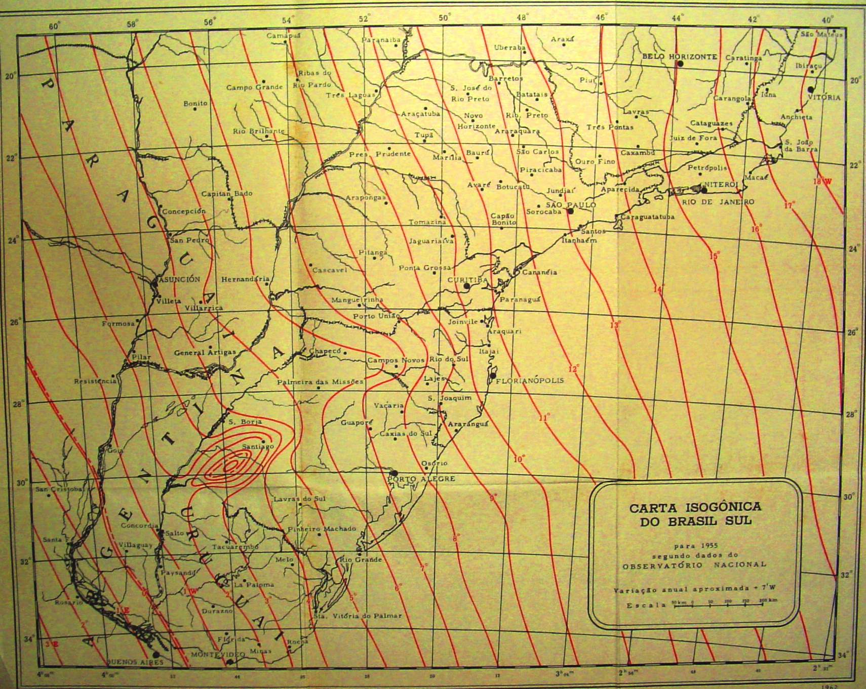
ANEXOF_CARTAMAGNETICA1955.jpg (1.50 Mbytes)
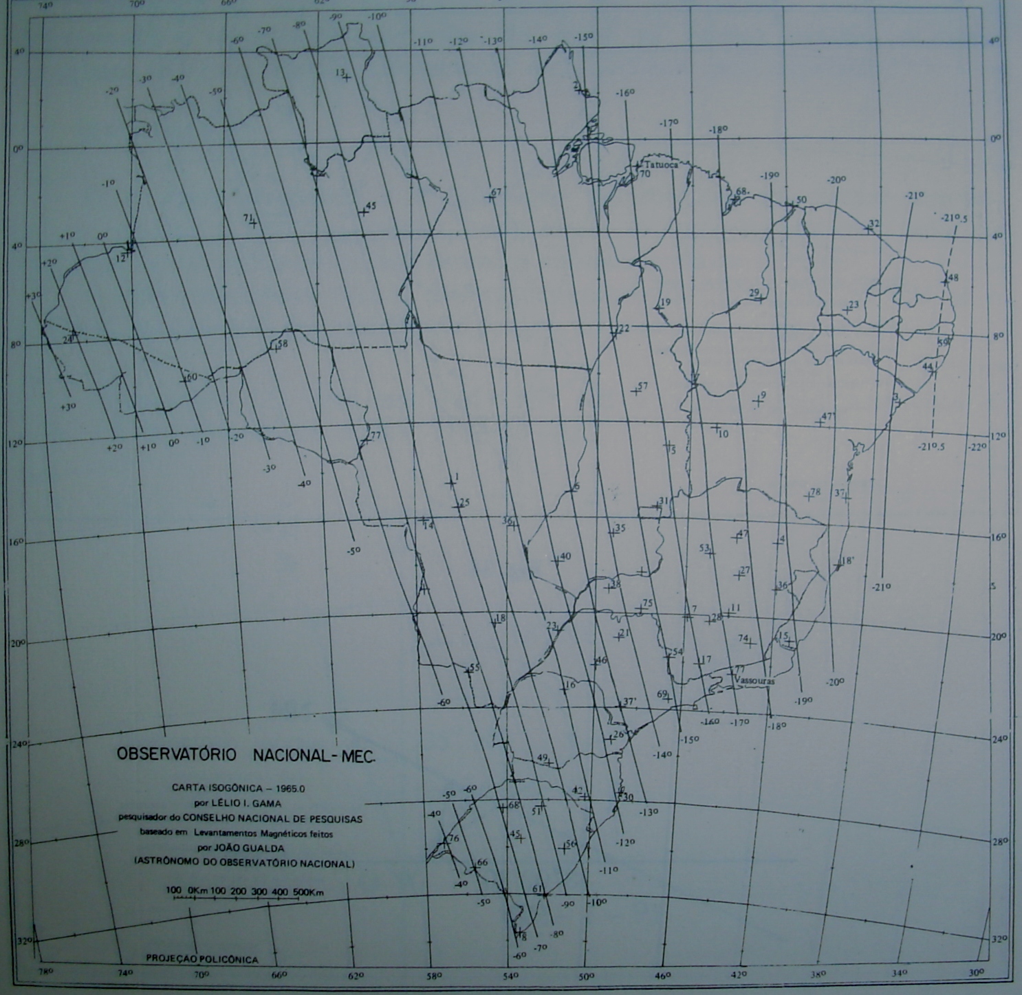
ANEXOG_CARTAMAGNETICA1965.jpg (830.63 Kbytes)
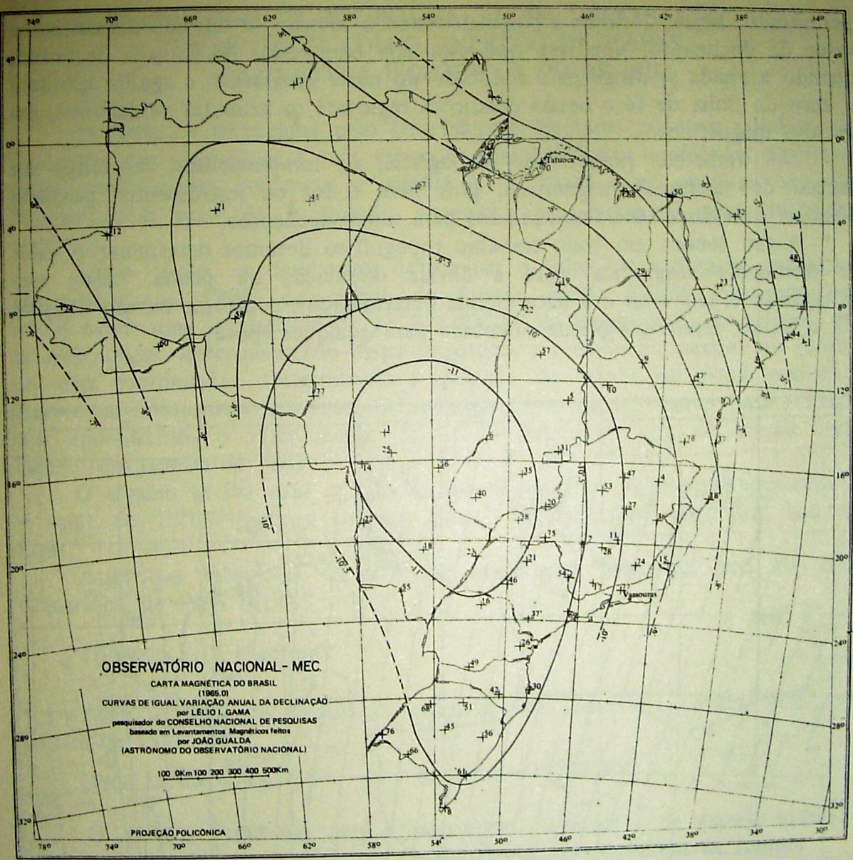
ANEXOH_CARTAVARIACAOANUAL1965.jpg (832.79 Kbytes)
ANEXOI_PLANILHADECALCULOSTOPOGRAFICOS.xls (8.55 Mbytes)
ANEXOJ_MANUALBASICODOGEOMEDIAPRO6.pdf (6.26 Mbytes)
ANEXOK_VERTICEV1755ESRN1755ES.pdf (221.29 Kbytes)
ANEXOL_RESUMOESPECIFICACOESINCRA.pdf (91.65 Kbytes)
ANEXOM_CALCULODECLINACAOPOLINOMIOHERMITE1922.xls (188.50 Kbytes)
ANEXON_PROCESSAMENTODOSDADOSDECAMPOGPS.pdf (97.07 Kbytes)
ANEXOO_MONOGRAFIAITAN01.pdf (1.14 Mbytes)
ANEXOP_MEMORIALDESCRITIVOCURUCUTU.pdf (159.49 Kbytes)
APENDICE_A.pdf (165.06 Kbytes)
MONOGRAFIA_FINAL_CAP_IV_a_VI.pdf (803.67 Kbytes)
MONOGRAFIA_FINAL_CAP_IX.pdf (2.32 Mbytes)
MONOGRAFIA_FINAL_CAP_IX_e_X.pdf (2.33 Mbytes)
MONOGRAFIA_FINAL_CAP_I_a_III.pdf (1.82 Mbytes)
MONOGRAFIA_FINAL_CAP_VII.pdf (16.34 Mbytes)
MONOGRAFIA_FINAL_CAP_VIII.pdf (3.40 Mbytes)
REFERENCIAS.pdf (62.75 Kbytes)
RESUMO_ABSTRACT_FICHA_CATALOGRAFICA.pdf (48.23 Kbytes)
Publishing Date
2008-10-31
WARNING: Learn what derived works are clicking here.
All rights of the thesis/dissertation are from the authors
CeTI-SC/STI
Digital Library of Theses and Dissertations of USP. Copyright © 2001-2024. All rights reserved.
CeTI-SC/STI
Digital Library of Theses and Dissertations of USP. Copyright © 2001-2024. All rights reserved.